-40%
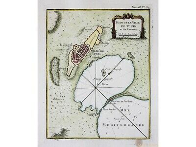
La Ville De Tunis et ses Environs Old map Africa Bellin 1764
$ 71.28
- Description
- Size Guide
Description
La Ville De Tunis et ses Environs Old map Africa Bellin 1764Title : Plan De La Ville De Tunis et ses Environs.
Nautical Chart of The City Of Tunis and its Surroundings.
Publisher:
Jacques Nicolas Bellin (1703 – 21 March 1772)
(Royal Hydrographer, engineer of the French Navy and member of the Royal Society)
Origin: L`Histoire Generale des Voyages.
ORIGINAL ANTIQUE COPPER PLATE ENGRAVING
With fine hand coloring.
Engraving is Absolutely Guaranteed authentic original map.
A Certificate of Authenticity will be on request forwarded for each individual map or print.
Sheet app.: 24 x 32.5 cm. 9.5 x 12.75 inches.
Image app.: 17 x 21.5 cm. 6.75 x 8.5 inches.
Condition: Very good clean engraving.
M
apandMaps.
For the complete Map and Print collection see our online site.
MapandMaps Cartography of the World.
Always real antique maps - Always original - Never reproductions.
Europe buyers; we accept payment in Euro.


